Radio Antenna Placement with 3-Dimensional Interactive Optimization

RA3DIO is a virtual reality tool that supports the design, optimization and management of radio network systems. It is the solution when you need:
- a fast tool to interactively place antennas and watch immediately the wave propagation prediction in a three dimensional terrain model;
- a powerful tool to minimize the number of antennas needed to completely cover a given terrain;
- a reliable tool to manage all your antenna data in a common database.
User Interface
RA3DIO has a very user-friendly interface. Each important feature can be accessed just by one mouse-click. The interface can be personalized and stored for each user independently. If you are familiar with standard Windows applications, then you will be able to use RA3DIO within minutes.
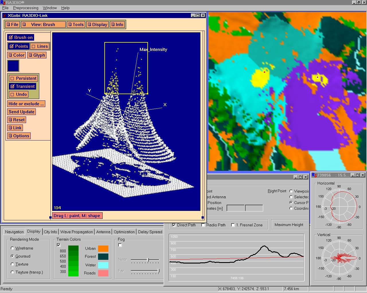
RA3DIO can be coupled with XGobi, a software package for the analysis of multivariate statistical data. Such a coupling allows a bidirectional interchange of data and linked brushing (highlighting the same point set in both XGobi and RA3DIO).
Terrain Data
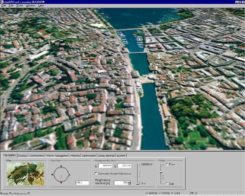
RA3DIO has a modular structure. The Terrain Explorer is the base module for visualizing and exploring 3-dimensional terrains. It offers a wide variety of navigation tools, such as map, compass, and stereo view among others.
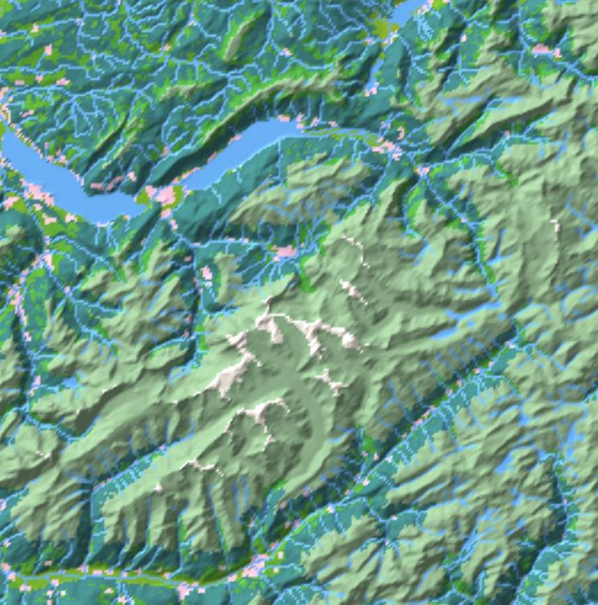
The triangulated terrains as used by RA3DIO are based on free or commercially available digital elevation models. Different formats of elevation data can be converted into the RA3DIO format with an additional terrain data converter tool.
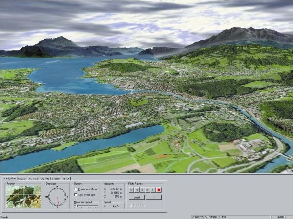
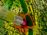
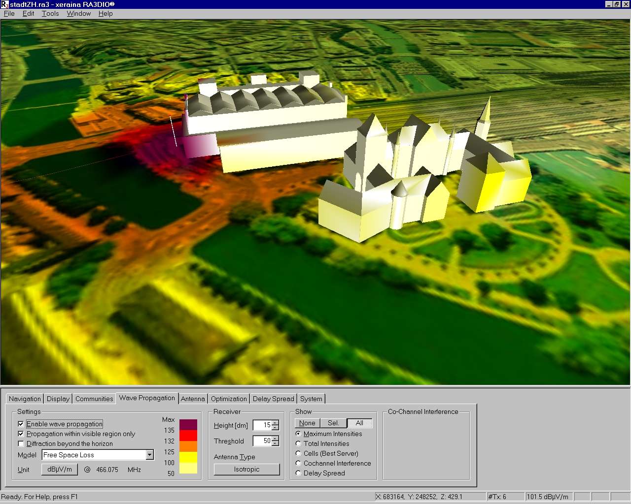
The visualized terrain is a combination of (adaptively) triangulated digital elevation data, land-usage data, and imagery (e.g. remote sensing satellite data, aerial ortho-photos, topographic pixel maps). The integration of three-dimensional buildings or entire city models is also possible.
Base Stations
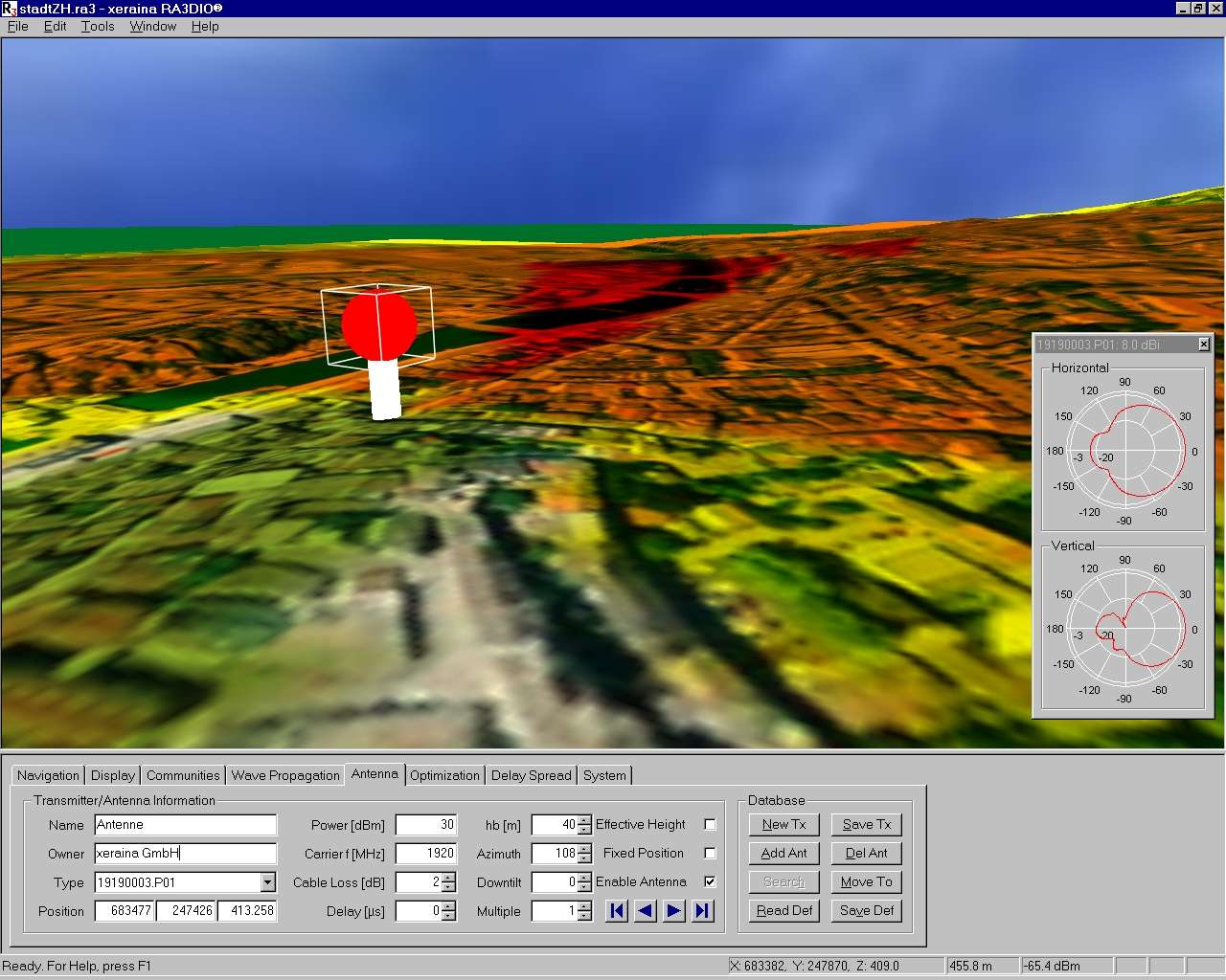
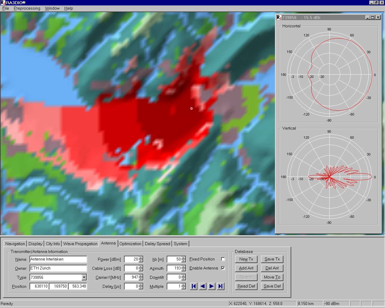
RA3DIO allows you both to interactively place base stations onto the terrain and to read the base stations data from a database. It also allows the use of radiation patterns of a wide variety of antennas of well-known antenna suppliers.
RA3DIO also acts as a management tool for base station data. It permits to store base station specific data in a standard database. In addition to the required data it is also possible to store customer-specific data. The strict separation of terrain and base station data allows you to easily integrate existing base station networks into RA3DIO.
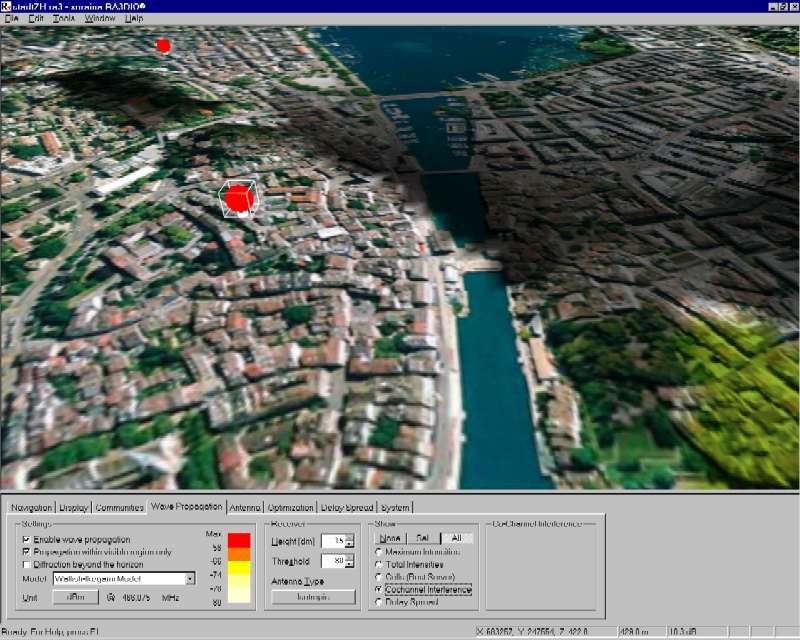
Wave Propagation
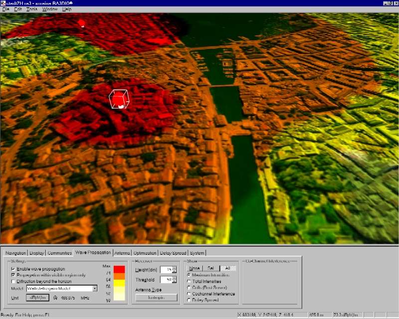
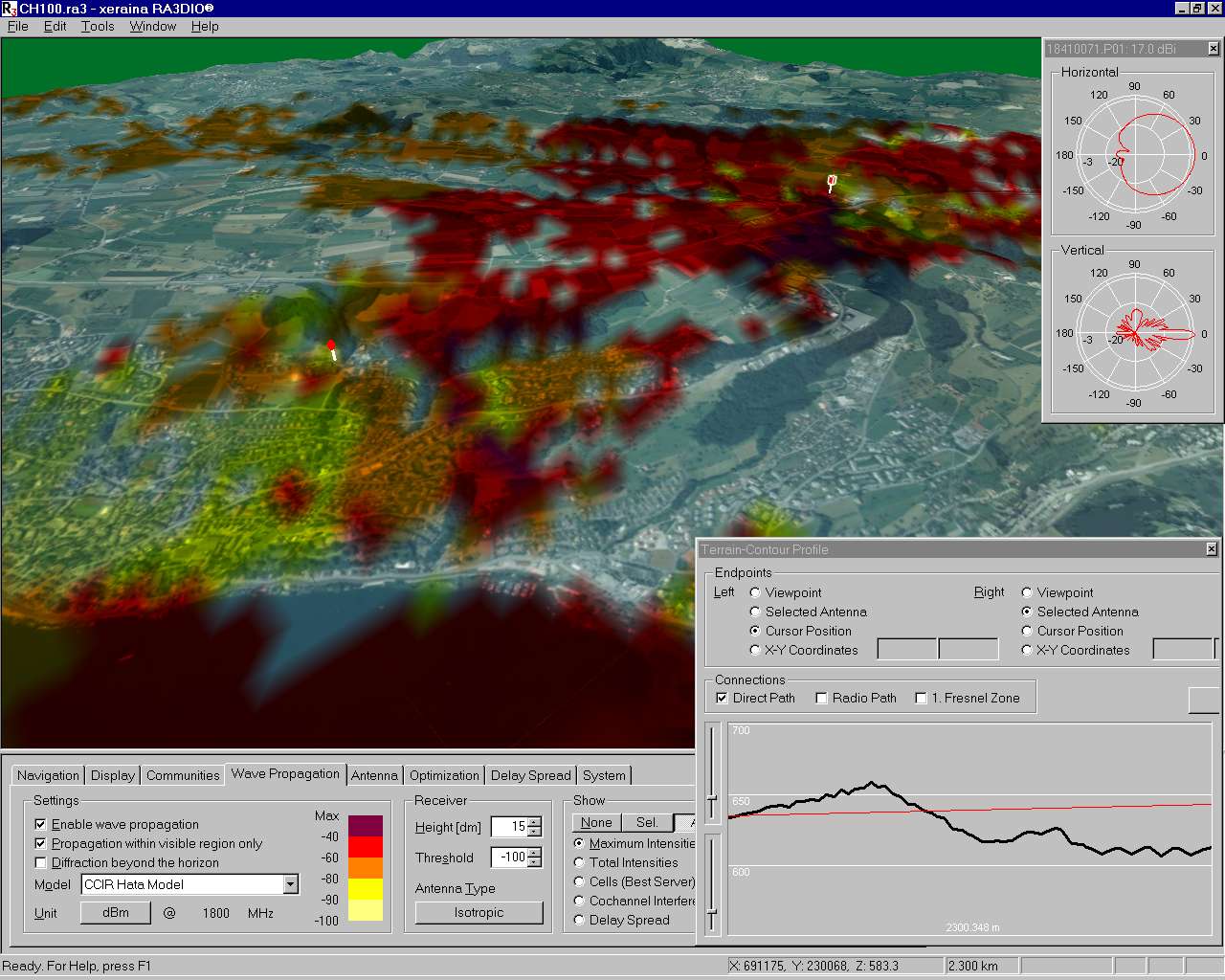
RA3DIO predicts the wave propagation of the antennas of a given radio network. The prediction takes into account the triangulated terrain, the antenna characteristics, and the wave propagation model. The predicted signal strength is shown in numbers and different colors.
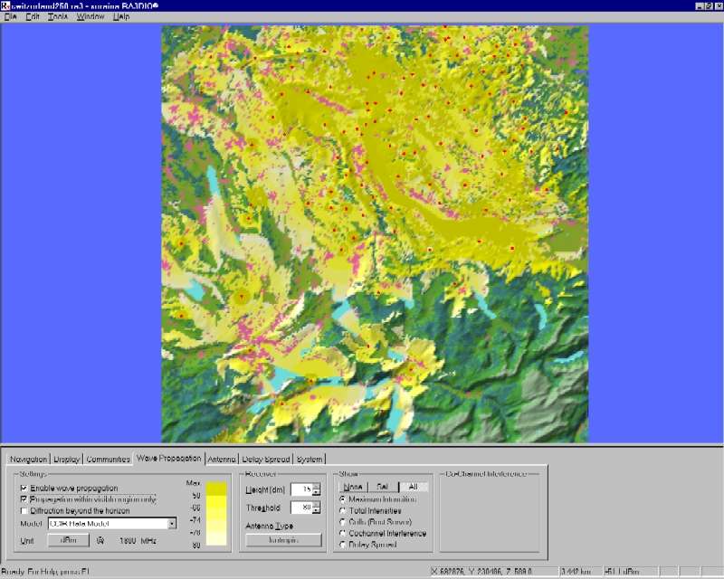
You can chose between several different wave propagation models: Free-space, CCIR Hata (150 to 1500 MHz), COST Hata (1500 to 2000 MHz), Modified Hata (100 to 3000 MHz), Longley-Rice (25 MHz to 40 GHz), Walfish-Ikegami (800 to 3000 MHz).
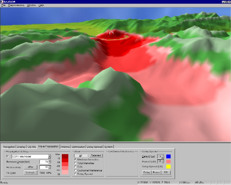
All propagation models can be combined with both line-of-sight computation and diffraction, and they also take refraction and earth-curvature into account.
Optimization
RA3DIO contains algorithms that place base stations automatically. The goal thereby is to minimize the number of base stations needed to completely cover a predefined area. This is one of the most attractive features of RA3DIO. Since it is impossible to find optimum solutions within reasonable time, these algorithms yield almost optimum solutions.
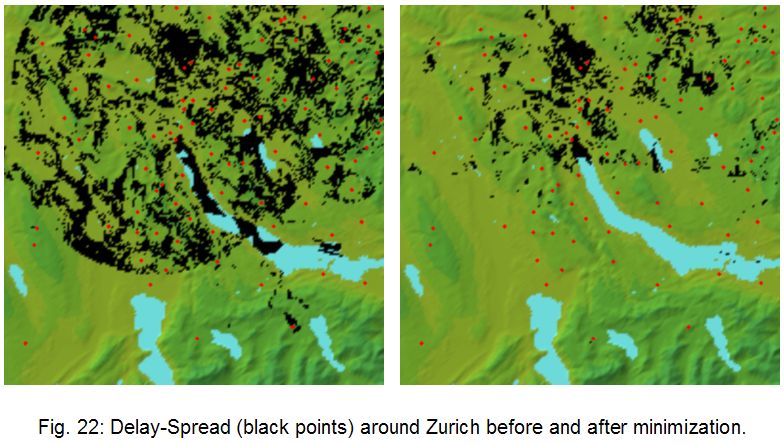
RA3DIO is also able to minimize different types of interferences (co-channel, delay-spread) in radio networks. Delay-spread is a phenomenon reducing the captured area in simulcast or quasi-synchronous radio networks like paging networks. RA3DIO is able to reduce the delay-spread area by seventy percent.